


Buying Guide for Portable Signal Jammers
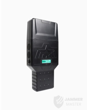
Key Takeaways Consideration Detail Product Weight Jammer Master’s portable jammers average 1.5Kg, significantly lighter than desktop models. Frequency Bands Capable of blocking multiple bands with


Unmanned Aerial Vehicles (UAVs), commonly known as drones, have revolutionized various industries, including aerial photography. The integration of GPS and inertial navigation technology has significantly enhanced the precision and functionality of UAVs during the photography process. However, the reliance on GPS signals for accurate positioning and navigation poses challenges when these signals are disrupted by electromagnetic interference. This article explores the significance of GPS and inertial navigation technology in UAVs and the implications of electromagnetic interference on their operational capabilities.
GPS receivers installed on UAVs play a crucial role in determining their precise location and orientation during the photography process. By combining GPS and inertial navigation technology, UAVs can accurately navigate and capture images from specific angles and positions. This integration ensures that the information obtained through aerial photography is meaningful and useful for various applications.
When the GPS receiver on a UAV experiences electromagnetic interference, the drone becomes solely reliant on the gyroscope’s inertial guidance, leading to a loss of accurate positioning information. Without precise GPS data transmission, the information obtained through aerial photography becomes meaningless. Consequently, UAVs can be considered as little more than flying cameras, lacking the ability to provide valuable insights in real-world scenarios.
UAVs heavily rely on communication signals for guidance during their flight. Without proper signal guidance, these drones cannot navigate freely in the sky. This limitation also implies that UAVs may not be as effective in on-site operations. The absence of communication signals restricts their ability to perform tasks and limits their overall impact in practical applications.
Electromagnetic interference technology can be widely applied in military-sensitive areas, government facilities, prisons, and other high-security zones. This technology aims to disrupt the remote control circuits of unidentified UAVs, interfering with their guidance components and constraining their remote control signals. By implementing electromagnetic interference, continuous protection can be achieved for 24 hours a day, ensuring the safety and security of these critical areas.
The integration of GPS and inertial navigation technology has significantly enhanced the precision and functionality of UAVs in aerial photography. However, the reliance on GPS signals for accurate positioning and navigation poses challenges when electromagnetic interference occurs. The absence of communication signals also limits the effectiveness of UAVs in practical applications. Nevertheless, the application of electromagnetic interference technology provides a solution to protect sensitive areas from unidentified UAVs. As technology continues to advance, further developments in GPS and inertial navigation systems are expected to overcome these challenges and unlock the full potential of UAVs in various industries.
Key Takeaways Consideration Detail Product Weight Jammer Master’s portable jammers average 1.5Kg, significantly lighter than desktop models. Frequency Bands Capable of blocking multiple bands with

In an age where the sky is dotted with drones, the importance of drone jammers has never been more significant. From commercial deliveries to personal

Protect your vehicle’s location privacy with a professional guide on GPS jammers. From selection to legal considerations and installation tips, we’ve got you covered. Key

Understanding Signal Blocker: How It Works and Its Applications Signal Blockers are devices that can disrupt mobile phone signals, preventing them from connecting to base

The Application and Benefits of High-Power Signal Jammers Enhancing Signal Blocking Efficiency in Various Environments In today’s technologically advanced world, the need for effective signal

Considerations for Purchasing Exam Room Signal Jammers Ensuring Effective Signal Jamming for Exam Integrity As the year approaches its end, many schools are preparing for

The Importance of Monitoring and Signal Interference Measures During Examinations During examination periods, it is crucial to closely monitor the examination venues and their surrounding

Selecting the Appropriate Cell Phone Jammer for Theaters and Auditoriums Overcoming Challenges in Installation and Maximizing Signal Disruption The Importance of Cell Phone Jamming in

Remote Control of Cell Phone Jammers via Smartphone: A Possibility? With the rapid development of the Internet of Things (IoT), numerous smart home devices have